Smart Traffic Stats
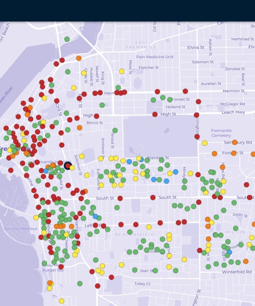
Site Comparison
Using editable colour schemes and three data layers - Speed, Classification and Volume, ATLYST enables you to quickly compare all sites and identify points of interest, such as rat runs, intense heavy vehicle traffic, and gaps in the survey network.
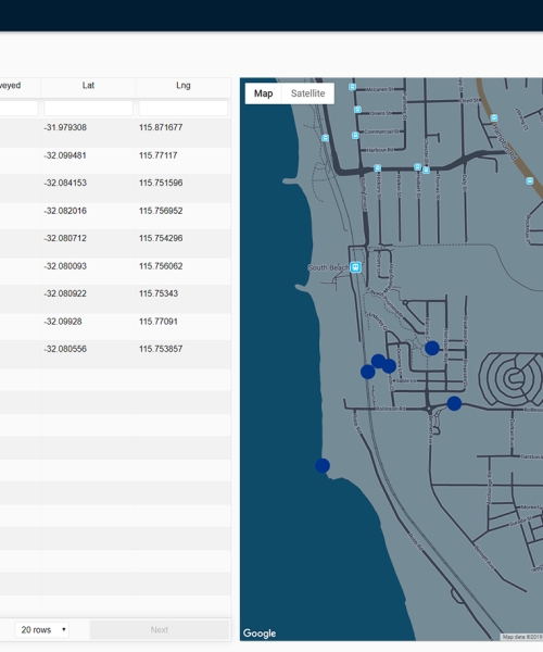
Drill-down analysis
With a simple click, access a detailed view of your site- the 85th percentile speed, ADT, peak hours, virtual days, etc. You can further apply filters such as Date, Class, Direction, Speed, and Headway to answer specific queries.
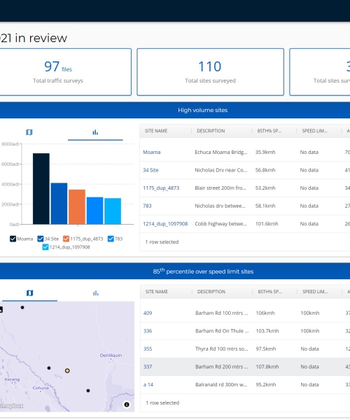
Changes over years
Build a historical collection of surveys conducted at the same location and compare data. The Site Merge tool will help you with file inconsistencies, such as site names and GPS coordinates.
Survey Management
Maintain Survey Consistency
Build a coherent traffic database by creating MTE® Site Lists from scratch or reusing previous survey details. Share your Site Lists with contractors to ensure your data stays well organised.
Validate Data Automatically
Easily drag and drop all your files into ATLYST. Once uploaded, the system will check each file against the parameters that you have set and inform you of anomalies that require further investigation.
Data Exporting and Sharing
Import Data In Other Systems
Download yearly summaries of all your sites into one .csv file. This information can then easily be imported into your GIS applications.
Keep Your Team Informed
Download and share comprehensive and graphical reports from every site. Opt for the latest available year's data or select multiple years to distinctly present traffic changes over time.
Share Your Data With Peers
With reciprocal agreements, you can view traffic data from neighbouring organisations. This unique feature allows you to identify adjacent traffic that might affect your road network, or to compare traffic patterns on similar roads.