ATLYST is great for insights and information use, especially for pavement design purposes. We use historical data, which is very easy to visualise, to predict increases in traffic and heavy vehicles. This helps us make an informed decision about choosing a growth factor to ensure a pavement is not under-designed.
Can you provide details on how you use ATLYST and how your organisation has benefitted?
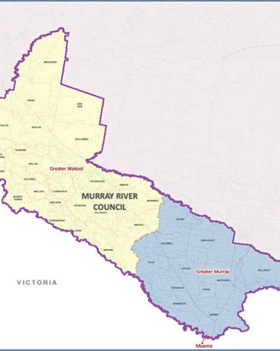
Prior to using ATLYST, we had a series of folders by year with approximately 1200 .eco files in them, numbered 1-1200. We also had spreadsheets for each year detailing that a certain number corresponded to a certain location. This made finding the required data very tedious and time-consuming. I personally have greatly benefited from ATLYST because now, when someone needs traffic data, instead of requesting it from me, they can simply log in and find what they are looking for.
What features do you find the most useful within ATLYST?
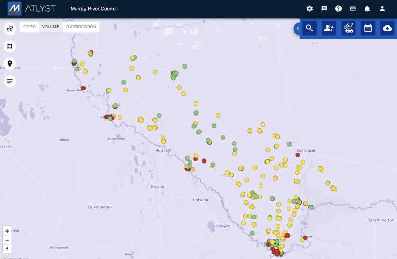
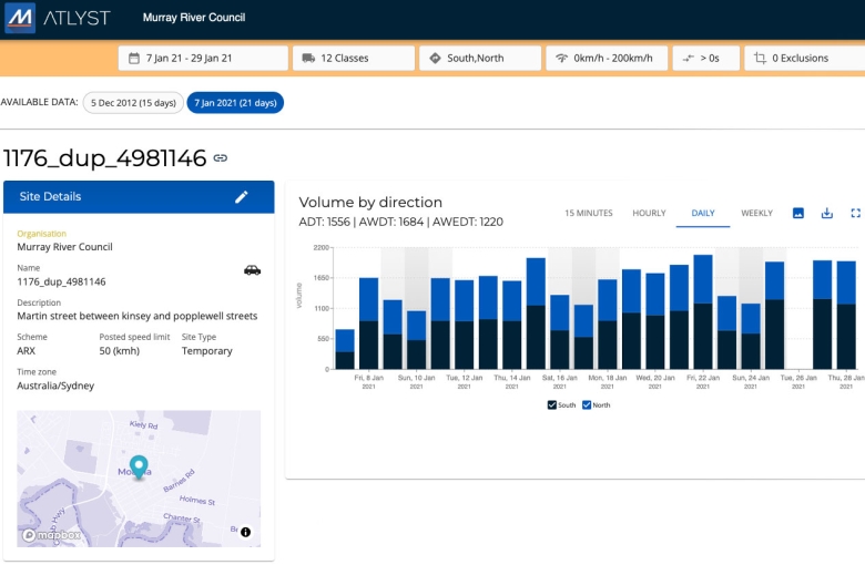
The ability to see all years AADT with a single click is extremely helpful for attempting to predict future traffic increases with past data. The standard report spreadsheets are also great to download and give a great deal of information instantly.
What do you see as the primary function of ATLYST in your organisation?
Subscribing to ATLYST was primarily to ensure we could let everyone in the organisation who needs traffic data see it immediately. As with our old system, if I were not available, then whoever was requesting information would simply have to wait until I had time to find what they were looking for.
Which problems does ATLYST solve in your organisation?
ATLYST has been helping us with the lack of shared information and with the internal process. There is no more time wasted for stakeholders requesting and waiting for data, and I do not need to waste time searching for relevant data as well.
How did you find the onboarding process, and how did you find the ATLYST support team?
Besides the time it took me to upload and plot all our past data into the system (1200 .eco files), the set-up process was very easy. I only had to discuss a couple of minor things with the support team where I had made a mistake and needed something changed, but those experiences were pain-free and efficient.
Can you share any outcomes from using ATLYST and how that may have positively impacted decision-making or planning within your organisation?
ATLYST is great for insights and information use, especially for pavement design purposes. We use historical data, which is very easy to visualise, to predict increases in traffic and heavy vehicles. This helps us make an informed decision about choosing a growth factor to ensure a pavement is not under-designed.
More about ATLYST
ATLYST® has been developed to revolutionise how you visualise, analyse, and share traffic data. Features are continuously added or upgraded to meet customers’ needs and tech developments.
Users of ATLYST:
- Save time in setting up surveys and processing data
- Get access to interactive maps and quick traffic data insights
- Can quickly share data and different reports with their team
To find out more about ATLYST and how it can streamline your traffic data analysis, get in touch with us today
Got a great MetroCount story? Share it with us and let the world know the great work you're doing in your community.